Day 42 - Sunday, May 12 - Milepost 3990
- Birdcount 202 - Fort Nelson, BC
(SF's Journal). As we pull out of Dawson
Creek I am amazed we are still getting a signal for our cellular phone. As I take my stint
driving through the unpopulated country full of spruce, spruce and more spruce, punctuated
by an occasional moose and more frequent caribou, I am comforted by the fact that I am
only a dial away from help should I need it. (We do loose a signal for a short time
however.) I have the unfortunate luck of the draw to be driving when we get to
"Suicide Hill", a 9% grade down to a river and time for me to give up the
steering wheel. I have a grip on the wheel so tight my fingers hurt. I have already
read ahead in the book for road conditions on tomorrow’s route and Bert gets to drive
all day. Suicide Hill is enough for me. As we travel north we seem to see the same set of
RV’s as they to head in our direction and travel at roughly the same speed. We
continually pass each other at turnouts, rest stops and gas stations. We pass the couple
we met in Calgary at least 4 times. Tonight’s home is West End Campground in Fort
Nelson (4.5/8/6) and we have to jump the car again. This time we are going to disconnect
the battery cable while we tow to see if that improves our percentages of not needing the
jumper cables. Mr. Hum comes back late this afternoon and seems to be related to
downshifting for as soon as we move the gear shift, the noise disappears.
(BF's Journal). With the time change the
sun now rises at 5 am. I use the extra hour to catch up on this journal, but soon we are
off for another day of long travel, this time starting at milepost 0 of the Alaska
Highway. As we head northwest toward Fort St. John, in the first fifty miles farms and
houses still are obvious, but thereafter the spruce forest takes over.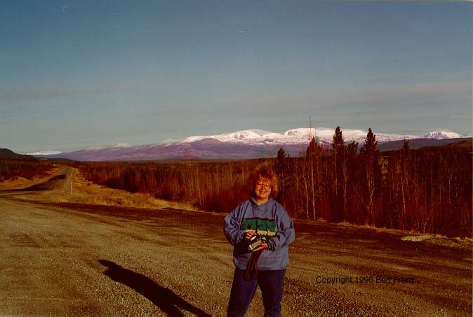 White Spruce flow like a sea
as far as we can see, rolling through the foothills up to the edge of snow covered peaks
flanking our left. Up close they look deep evergreen, but in the distance the spruce turn
ever deeper shades of purple until they join the sky, a powdery blue sky interrupted
briefly with cotton candy clouds. White Spruce can tower to 200 ft, but the ones we see
are 20 - 50 ft suggesting these are mostly regrowth from earlier clear cutting.
Nevertheless, the forest looks untouched without evidence of humans except for straight
fire break cuts covered with snow and spaced every few miles. When we reach the crest of a
hill, the distant forest looks like a vast green field striped with an airport runway
painted white. We cross Beaver Creek and huge red swatches splash across parts of the deep
green forests. As we pass a red section up close, we can see Trembling Aspen showing red
buds. Like trees we have watched since we left Texas, we catch spring in the bud stage and
we push on just before they burst into green leaves. We spot a moose near milepost 80 and
later come upon seven others. But the group of seven doesn’t seem right - too many in
one group, too skinny, smaller heads, etc. Further down the road we see three more and
soon it becomes clear that these are not moose but rather Woodland Caribou. Then we see
another, and another, and two more at Prophet River and still two more after that - all
caribou looking like bulky deer with fluffy white collars, dark bodies, white tails and
the starting growth of antlers. We eat lunch at a small, graveled pullout near Adsett
Creek. A sign identifies the road section we are about to travel, the Adsett Creek
Realignment, completed in 1992. The rerouted section removed 132 curves from 35
miles of the original Alaska Highway. The sign quotes a traveler of the old road who
wrote:
White Spruce flow like a sea
as far as we can see, rolling through the foothills up to the edge of snow covered peaks
flanking our left. Up close they look deep evergreen, but in the distance the spruce turn
ever deeper shades of purple until they join the sky, a powdery blue sky interrupted
briefly with cotton candy clouds. White Spruce can tower to 200 ft, but the ones we see
are 20 - 50 ft suggesting these are mostly regrowth from earlier clear cutting.
Nevertheless, the forest looks untouched without evidence of humans except for straight
fire break cuts covered with snow and spaced every few miles. When we reach the crest of a
hill, the distant forest looks like a vast green field striped with an airport runway
painted white. We cross Beaver Creek and huge red swatches splash across parts of the deep
green forests. As we pass a red section up close, we can see Trembling Aspen showing red
buds. Like trees we have watched since we left Texas, we catch spring in the bud stage and
we push on just before they burst into green leaves. We spot a moose near milepost 80 and
later come upon seven others. But the group of seven doesn’t seem right - too many in
one group, too skinny, smaller heads, etc. Further down the road we see three more and
soon it becomes clear that these are not moose but rather Woodland Caribou. Then we see
another, and another, and two more at Prophet River and still two more after that - all
caribou looking like bulky deer with fluffy white collars, dark bodies, white tails and
the starting growth of antlers. We eat lunch at a small, graveled pullout near Adsett
Creek. A sign identifies the road section we are about to travel, the Adsett Creek
Realignment, completed in 1992. The rerouted section removed 132 curves from 35
miles of the original Alaska Highway. The sign quotes a traveler of the old road who
wrote:
Winding in and winding out
Leaves my mind in serious doubt
As to whether the man that built this route
Was going to hell or coming out.
 Next
Day
Next
Day  Itinerary