Chapter 15. Yukon Territory
![]()
(Shari) Before we leave Eagle we drive to the end of the main road and see the Old Eagle village site cleared of all buildings and Bert goes out to photograph a collection of trucks smashed by the ice during the 2009 disaster. We catch up with Norm and Cindy at the Visitor’s Center and together head out of town at 9 AM. Again I drive, and again the scenery is fantastic. Sunshine makes all the difference in the world. We meet few cars, five to be exact, in the 3-hr. drive to the turn off on to the Top of the World Highway. Once on that road, traffic is heavier.
We stop for lunch before we have to cross the Canadian border and eat up the tomatoes and Bing cherries, I think may be confiscated. At the border we are asked about alcohol, firearms, and agricultural products. We tell the agent about our 1/3-filled bottles of gin and scotch and three beers in the refrigerator. We have no guns or cigarettes, and I mention what fruit and veggies I have in the refrigerator. He tells us to eat the two apples before we go into British Columbia and sends us on our way. Cindy and Norm are not even asked about fruits and vegetables.
The road from here on is good to terrible. In some spots the washboard is teeth-chattering and we don’t know which is better: to go 5 mph or 35 mph. Five mph is nerve rackingly rough; 35 is smooth, but we are afraid of breaking something. Bert alternates his speed. Luckily the whole road is not like this and improves the closer we get to Dawson City. This is our sixth time on this road and this is the worst condition it has been. But then the sun is out and I have never driven it with such a clear view of the layers of mountains in shades of blue stretching ten deep in places. We lost Cindy and Norm so stop at a wayside to wait for them before heading down the hill to Dawson City. You should see Bert loose 2 in. of height when Cindy tells him of the Northern Hawk Owl she saw. Every cell in his body deflates as she relates her story and then rubs salt in his wound with a great picture of the bird on top a spruce. We arrive at the ferry to Dawson City about 4 PM. A Good Sam caravan is waiting to cross the river on the ferry. We pass the long line of Class A motorhomes and turn into our campground, before the ferry loading point. I have always wanted to camp here on the Yukon River and now is our chance. We pull into the first available level site, in the woods, and Bert quickly gets out to save a spot for Norm and Cindy. As luck would have it, their spot is a wonderful waterfront site. I invite myself over to their site for social tonight as here we can sit in front of the campfire and watch the river traffic while sipping beer and wine and joining in dinner. Wow, life is good!
(Bert) Before we leave our riverside campground, Shari and I walk along the sandy beach to the wreck of an old steamboat pushed up on the shore and now ensnarled by the forest. We can see the tilted smokestack, the smashed paddle wheels, and the crushed decks. It reminds me of the stories we read at various Mississippi River museums about the many disasters these steamboats succumbed to, mostly from explosions.
There is almost no one in line when we move our RV to the departure point, so we are first on the ferry for transit across the river to Dawson City. Our first stop is at the Northwest Territory Visitor’s Center to get the latest news on the road condition, the weather forecasts, and the position of the caribou herd. Then we do the same at the Yukon Territory Visitor’s Center, also stopping there to watch a video on the Gold Rush era and Dawson City’s roll in its history.
(Bert) Again another day of superb weather, temperatures are in the 60s. Probably more than any other village or town in Canada, Dawson City has been preserved and maintained to give a fair representation of how it looked a century ago during the gold rush days: dirt streets, boardwalk sidewalks, wooden storefronts, and still a few log cabins, including the one where Robert Service lived when he did some of his writing. Although we have been to Dawson many times and toured much of it, the one activity we repeat each visit is the Robert Service reading which takes place in front of the two-room cabin preserved intact as it was at the turn of the 19th century when Service lived there. Through the years the history teller and poetry reader has changed and today, for the first time, it is a lady. Janice does an excellent job. Service wrote 2000 poems and today I hear a couple I’ve not heard before. We also hear again the very familiar “The Shooting of Dan McGrew.” Janice tells us that one poem earned Robert Service a million dollars.
(Bert) After we stock up on groceries and fill our tanks (water, fuel, propane), we are off on another adventure: the Dempster Highway to Inuvik (pronounced eh-NEW-vick). The adventure stalls at the campground when we cannot retract two of our jacks. After 20 min. of fidgeting, prying, digging, shifting forward, shifting backward, retracting, dropping, and anything else we can think of, we get the jacks to spring up into travel position. It seems the main problem was the deep gravel where we parked prevented the spring action to pull up the jacks. Next we discover, in all the commotion with the jacks, that we forgot to dump our waste tanks. Fortunately, at the start of the Dempster Highway another RV campground has a waste dump that we can use for a $5 fee.
We take photos of the decorative interpretative sign announcing the start of the Dempster and then we are on the gravel highway heading north. If all goes well, we will reach the Arctic Ocean area in a few days. Most of the gravel road today is surprisingly smooth and hard packed, though several miles are potholed enough for me to slow to 10-20 mph. Alongside of us is the North Klondike River, the boreal forest, and, beyond, the high reaching Ogilvie Mountains as we drive through Tombstone Territorial Park. A dark phase Harlan’s Hawk circles above us.
In early afternoon we stop at the campground in the territorial park and pick a secluded site hidden by 6-ft. willows and absent of facilities other than a picnic table and fire ring. At 7:30 we attend a presentation held in the cook shack. Margaret grew up in Old Crow in Vuntut Gwitch-in First Nation territory, which is part of the Athabasca nation. Old Crow is in the far north, west of Inuvik. She went to high school in Whitehorse and has worked for Yukon Parks most of her life, often as a speaker. Her presentation is impressive because it is about her people and their life style, supplemented by photos from her past and personal items made by her mother, stepmother, and herself. When explaining caribou hunting, food gathering, housing, clothing, dog sleds and the elaborate methods of making things from all parts of caribou, muskrats, and moose, I ask Margaret if this is the past she is describing, or is this still the way the people live in Old Crow now. She tells us it is ongoing and those children that do not continue in school will learn the old ways and continue living off the land and animals.
However, some things are changing. Global warming is having a detrimental influence on the Porcupine Caribou Herd, the mainstay for the traditional First Nation way of life. In the past, the people always knew where to find the Barren Ground Caribou, especially during their migration between winter and summer ranges, across the Porcupine River beginning late May. Now the caribou have become confused and the timing and range in which they wander has become unpredictable. Another change is that in the past Old Crow had only dry snow. Now it is wet snow and their clothing is inappropriate.
Aside from Margaret’s talk, I have been reading a booklet on ice patches. Like glaciers, ice patches are accumulated snowfall that has compressed into ice. Unlike glaciers, the ice does not flow, but instead stays in situ for hundreds or even thousands of years. The major difference is that anything dropped on the ice patches remains frozen intact until global warming melts the ice. In September 1997, the Yukon Ice Patch revealed caribou dung piled so deep it must have taken thousands of years and/or thousands of caribou to accumulate. (In summer, caribou visit ice patches to escape biting insects and they stick their noses into the ice). Also, buried among the dung are ancient artifacts such as dart shafts, stone points, bow and arrows, etc. that have been carbon-dated to 900-9000 years ago. Even a 1400-year-old leather moccasin was discovered. Archaeologists usually have to reconstruct the past from discoveries of stone tools, but what is unique about these ice patch artifacts is that they include materials that elsewhere would have decomposed, thus providing a far greater source of historical information.
(Bert) Before we leave Tombstone, I visit with Margaret at the Information Center. I get a few more details about her Vuntut Gwitch-in ancestry and she shows me the skull with intact teeth of a Giant Beaver. Positioned beside a normal beaver skull, it looks like the Giant could chump down on the little one with one bite. Margaret says the oral history of her people reveals that the Giant Beaver–larger than a Grizzly Bear–attacked humans. I also get more details about birding the Dempster Highway in May and June, a birding trip we are considering for some future year.
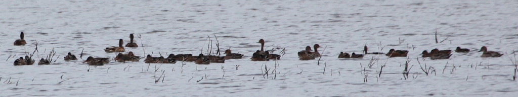
As we head north we will pass through several ecoregions. We quickly drive out of the boreal forest and are in a broad, treeless, tundra valley, surrounded by ragged alpine peaks. An adult Bald Eagle soars near the cliffs and drifts overhead. Occasional small ponds are rounded in the fashion of thermokarst lakes created by the repeated seasonal action of permafrost. On two of them I see ducks, but they are distant and at this time of year many species of ducks look the same in their eclipsed plumage. I take photos to see if I can recognize the species when I put up the images on my computer. At Two Moose Lake–one of the biggest thaw lakes–I find two Red-throated Loons. In the short willows I hear, and sometimes see, White-crowned Sparrows and Yellow Warblers, but mostly the fall season is stingy on birds.
We have come to Dempster Highway to see brilliant fall colors which peak in mid-August. We are a bit early and so far the only fall colors are scattered yellow leaves in the dwarf willows and a yellow-green cast to the vast tundra. The scenery changes again. Now the mountains are smoothly rounded, though decapitated by gray clouds. To our right runs a shallow braided river, multiple rivulets trickle over smooth gravel. We are in the Blackstone Uplands where the gently rolling hills are edged by higher peaks, but none of the terrain has been formed by glaciers. Farther on, exposed light gray limestone mountains are flanked by steep slopes, some of which are covered by aged lichens. We enter a valley that must sustain more rainfall because the trees now are taller, more Black Spruce, and along the river Balsam Poplar and taller willows. In another 10 km, the spruce are thinly dispersed across the valley and creep up the mountain sides in shorter stature, but only on the south sides, the north being barren scree. I am fascinated over how the scenery can change every few miles.
We stop for lunch at Windy Pass, in an area that holds the most fascination for me. So much is now known about the Ice Ages since I went to school. Museums and exhibits we have been visiting tell of Beringia, even showing detailed maps of the shoreline borders of the land mass that connected the continents. Beringia was untouched by the glaciers and the area where we drive now has seen little change in the past 100,000 years. In my imagination I can see the herds of Wooly Mammoths, the roaming Giant Bison, the extinct horses the size of ponies, the occasional Scimitar Cat with fearsome canines. And, also, here crossed the first people some 8-10,000 years ago, the ancestors of Margaret and other First Nation people.
The giant mammals are now gone, but the birds are still here. We stop at an extreme cliff bordering the road and high up we can see the accumulation of sticks and branches that define the nest of a Gyrfalcon. Even higher, at the crest of the cliff, perches the falcon. We do not find caribou or sheep, but we do see their trails etched into the stone slopes. They say the Dall’s Sheep come down to the red stream to indulge in the high concentration of dissolved minerals.
Our campsite for the evening is at Engineer Creek, in the shadow of Sapper Hill, a limestone scree capped with hard dolomite. We are surrounded by poplar, willow, and alder, and use the provided firewood for a campfire. Not needed tonight for warmth–it is 66ş from 3 pm to 7 pm–the fire does provide a cheery place to rest, read, and make travel plans, and Shari uses the fire to skewer shish-kebobs for dinner. For dessert, we roast marshmallows for som’mores.
(Bert) Thirty-eight degrees at 7 AM is cold, but not cold enough to initiate fall colors. Although I can find a few orange Dwarf Birch leaves and some red Alpine Bearberry leaves, everything else is still green. By 9:30 it is already 48ş and continues to climb as we enjoy another good-weather day. We break camp and soon cross Engineer Creek just as a pair of Merlins flies overhead. We travel through a land of Black Spruce, although a gently rolling sea of green needles might seem a more apt descriptor. The monotony of spruce is broken by the curious crowns of the horizon mountains. First, it is hardened dolomite laid barren of cover. Then it is torrs, the same except these have been shaped by centuries of frost shattering until they have become isolated sculpted towers of stone. By far the most unusual is a distant rock that has taken on the uncanny shape of an elephant–or maybe mammoth, given the former residents–complete with body, head and elongated trunk.
We follow the shoreline of Ogilvie River, named after the surveyor who marked the Alaska-Yukon border in 1887, the 141st meridian. Then we climb out of the valley and ride the ridge line that marks a continental divide. To our right we see the Peel River which flows into the Mackenzie and thence to the Beaufort Sea, a part of the Arctic Ocean. Land to the west drains to the Yukon River which eventually threads across Alaska to the Bering Sea, the northern part of the Pacific Ocean.
I point out Wild Rhubarb to Shari and she immediately samples some. I suspect
the edible portions would be better in spring. Now they sport long, bright-red
stalks and large yellow leaves, and mixed with the spent pinkish-red stems of
fireweed, they add color to the landscape. In fact, we soon reach the burn area
recovering from a 13,000-acre 1991 forest fire. For miles to the horizon, the
forest is reduced to charred spruce trunks sticking out of a bed that glows pink
with fireweed stalks. Apparently, forest fires are common here, initiated by
lightning and, as in the case of this one, they start in the hot (mid-80s)
summer month of July and burn until the fall snow and rain of mid-August.
The afternoon is spent crossing the Eagle Plains. I associate “plain” with flat land. However, Eagle Plains are undulating hills entirely blanketed by spruce. Perhaps the foliage changes in the low spots, but we are riding the crest. In wetter areas I see some White Spruce and Tamarack, but mostly it is an unbroken pattern of spindly, short Black Spruce. Twice we stop to study a hawk with an oddly pale, almost white, head. The rest of its feathers define it as a dark phase Harlan’s Hawk. I am hoping for a hawk owl, which we did find here in another year, but none today. However, we see something new: the rigging of an oil well in process. Later we see another and we don’t recall any oil drilling activity on our 2008 trip. We reach the Eagle Plains settlement, one expansive business that is a catch-all for the traveler: hotel, campground, restaurant, gas station, repair shop. We have the luxury of 15-amp electricity tonight.
(Shari) I have been in a funk for the past two days. I so wanted to see fall colors on the Dempster Highway. It was my only reason for making the trip. But everything is green. I miscalculated and I thought we were only going four days earlier than our last trip but it is ten days. I am ready to turn back as the road is also much worse than last trip. Now having driven the Dalton Highway this year in the same vehicle, I have a point of comparison and the road is 3 on a scale of 5. The Dalton is a 4 mainly because of the long 100-mi. stretches of smooth pack or pavement. This road is consistently potholed and I rarely get above 30 mph.
(Bert) Little by little we see changes in the foliage and larger differences in the ecoregions. After crossing the Eagle River bridge, spruce trees are absent or stunted. Vast fields of grasses, gathered into tussocks, are yellow green. When we reach a treeless high point I spot a black-and-white bird flying to my left and Shari stops for me to get a better look of the Northern Wheatear, but I cannot find it again. Only two kilometers farther we are at the Arctic Circle and we stop again for photos. While Shari starts picking berries I scan for birds and find three Boreal Chickadees hiding in a few low bushes that would be larger trees in a warmer climate. After 20 min. of berry picking Shari shows me the small bagful she has gathered. They are red Lowbush Cranberries and black Crowberries. She has only a few Lowbush Blueberries to show for herself and complains that she hasn’t seen more. While I am looking for birds at a row of bushes, I come upon a good patch of blueberries, pick a handful, and go back to show Shari. Now she joins me and together we pick enough for a meal. Just as we are leaving we meet another birder and in the conversation we find out that Alice is a birding guide in Hawaii. As we discuss birds and berries, a pair of Merlins flies overhead, one almost acting as if it will attack us.
Now that we have crossed the Arctic Circle, we recall the upcoming valley as the place where we saw grizzlies and caribou last trip. We are on the lookout. Only two miles farther, Shari sees one on the road and accelerates to the spot. We watch the dark caribou at the side of the road as it trots up the hillside while I step outside to get better photos. Continuing through the beautiful valley, we see more wildlife–Arctic Ground Squirrel, American Kestrel, several flocks of American Pipits–and then at KM 436, far on the hillside I spot three more Barren Ground Caribou. These three are sporting magnificent antlers that are of immense size. Two of the caribou face each other as if they are going to spar. Their antlers rise above their heads to a distance greater than that from head to ground. A couple miles farther we see two more caribou, but these have been shot and the Gwitch-in hunters–carrying high-power rifles–and their wives (and a baby) are standing over the carcasses, perhaps discussing how they will transport them across the field to their parked car with a Northwest Territory license plate.
(Shari) Today the road gets better and we hit pay dirt on colors. The scene may not be an array of colors but it is beautiful anyway. Everywhere I look I see yellow. Seas of yellow climbing the hillsides and down in the valley and yellow throughout the meadows. Just yellow, yellow, yellow! It is quite striking and makes animal watching easy as they stick out like a sore thumb against the yellow background. We see caribou with racks larger than I have ever seen. I would think they could not eat with racks that size. The First Nation people also take advantage of the changes. Hunting season is open for them and we see a group not far from the road, looking down at their kill of two caribou.
We are trying to slow our travels to catch the fall colors on the way back. I pick berries at the Arctic Circle marker. Here the blueberries are just about gone and lowbush cranberries are not quite ripe. They are best after the first frost which should be any day now. The crowberries are just right. These are purple berries tasting a lot like a bland blueberry. They are good to mix with other berries. We stop early for the day, traveling only about 100 mi. At our campsite the soapberries are all over the place and I spend the next hour picking them. These berries are bright red, a lot like currants and my book says they taste bitter. The berries surrounding the campsite are not bitter but so ripe that my hands are wet and sticky by the time I quit picking. The First Nation people mix them with water and syrup and beat it into a whipped creamlike dessert. I shall try that. I would also think I could put them in muffins. The berry has a small pit, but is edible. Bert builds another campfire and we enjoy its warmth before roasting sausages over the flames for dinner.
(Bert) Although it is early, we stop for the afternoon and evening at a campground along the Rock River. Here in the valley we are again surrounded by a forest of spruce and poplar. Behind our site flows the river, bright rusty red from high mineral content. The red waters have even dyed the streamside rocks. Those unpainted rocks farther from the steam have fascinating shapes, many cut into triangles, squares and sheets upon the fracture lines of the black slate. I find two limestone rocks imbedded with dozens of fossil plants. Looking at this arctic terrain, it is hard to imagine this land once lay under a tropical ocean.
Given the late season, the birdlife is plentiful. A family of three American Kestrels screams in flight above me. In the forest I stumble upon a photogenic Varied Thrush accompanied by an equally photogenic Swainson’s Thrush. Nearer our campsite, Boreal Chickadees chatter. A campfire takes the chill out of the early evening and we roast reindeer sausages over the hot fire.
![]() Next
Day
Next
Day ![]() Table
of Contents
Table
of Contents